Local review required before publication. Operational details last verified on September 28, 2026.
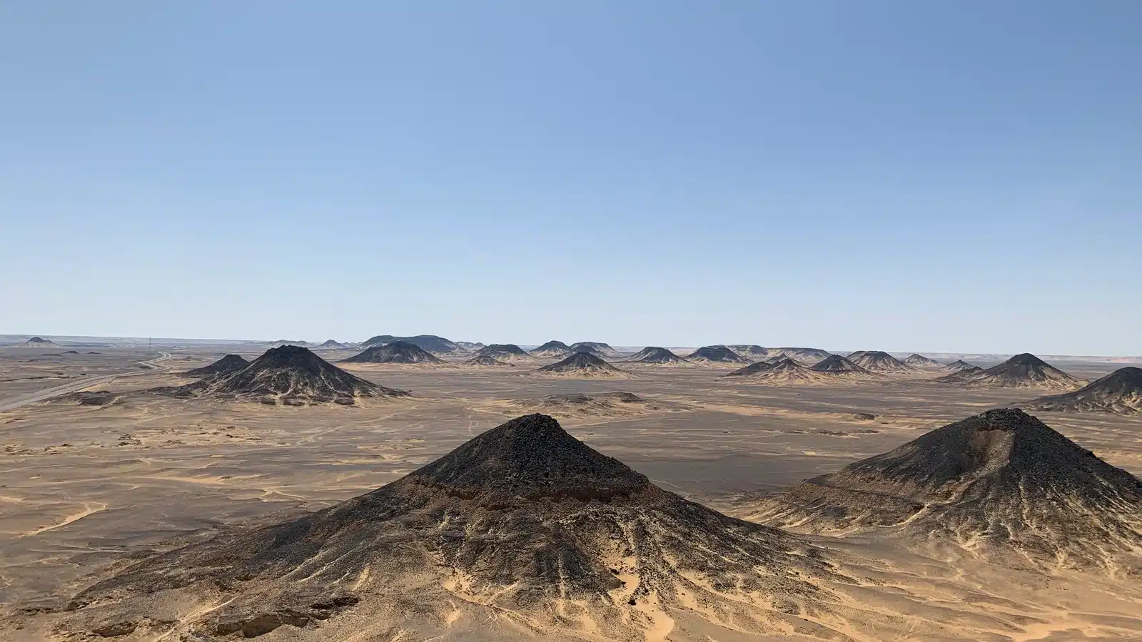
Black Desert Egypt is the dark, open counterpoint to the pale chalk scenery farther south. Around Bahariya Oasis, ochre ground is interrupted by black stones, dark-capped hills and wide ridges that can look almost volcanic. The landscape is commonly visited by 4×4 on the route toward the White Desert rather than as a long standalone destination. Its geology is more complicated than the simple phrase “volcanic desert,” and different hills or surface materials should not be assigned one origin without evidence. This guide explains what visitors actually see, how the Black Desert fits a one-, two- or three-day safari, where photography works best, and how to walk responsibly. It uses cautious geological language and avoids directing readers to sensitive coordinates or encouraging off-trail climbing.
Quick answer
The Black Desert is a landscape of dark-capped hills and black stones near Bahariya Oasis, usually visited on the route toward the White Desert. Its appeal is the contrast: ochre sand, dark ridges, wide viewpoints and a completely different visual character from the white chalk formations farther south. Most visitors see it by 4×4 as part of a day, overnight or multi-day safari rather than as a standalone long visit.
Table of contents
- What is the Black Desert?
- Why the landscape looks black
- Where it fits the route
- Viewpoints and stops
- How long you need
- Best light for photography
- Walking and climbing
- Black Desert versus White Desert
- Sample itinerary
- Responsible visiting
- What to bring
- FAQ
What Is the Black Desert in Egypt?
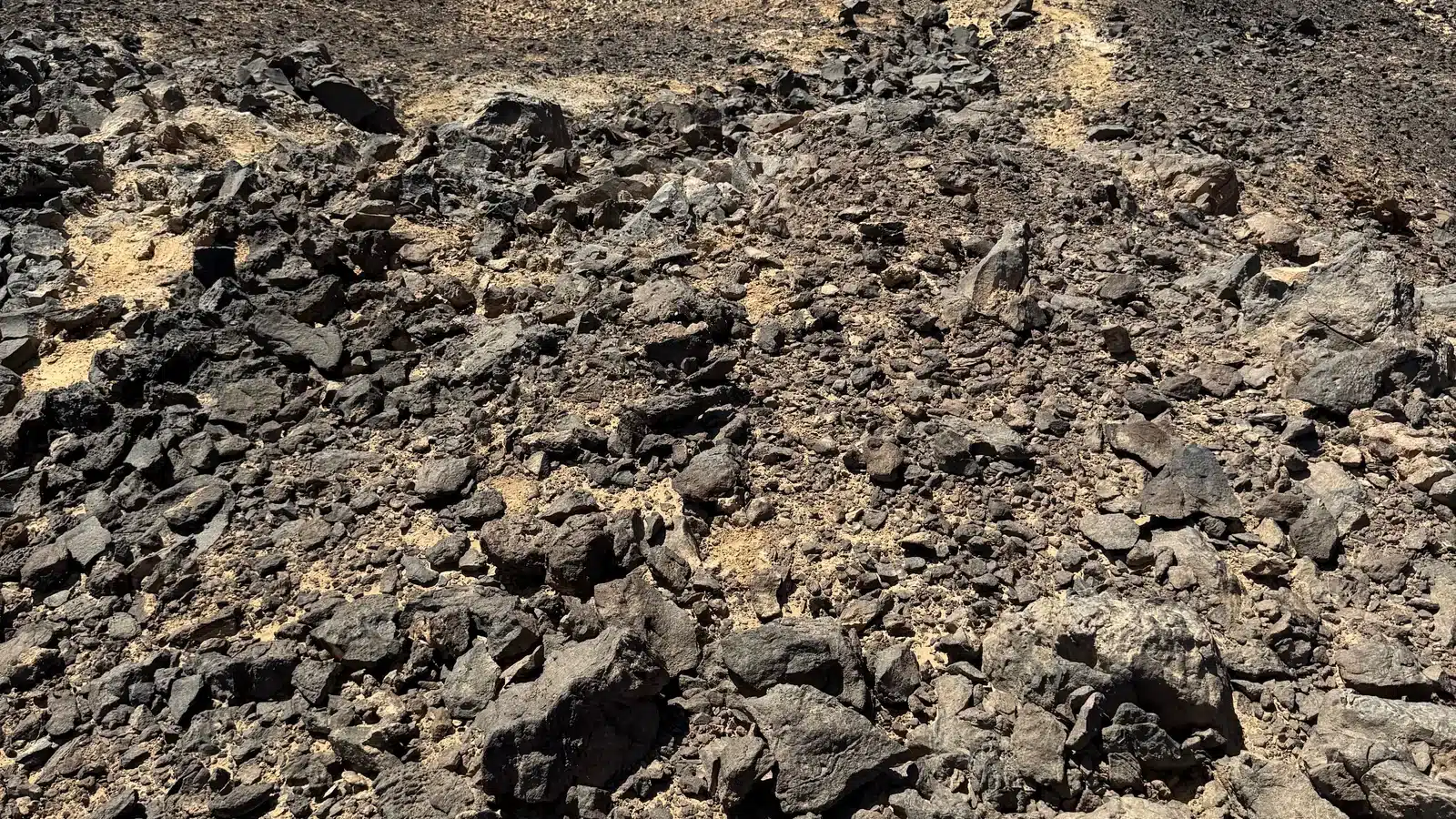
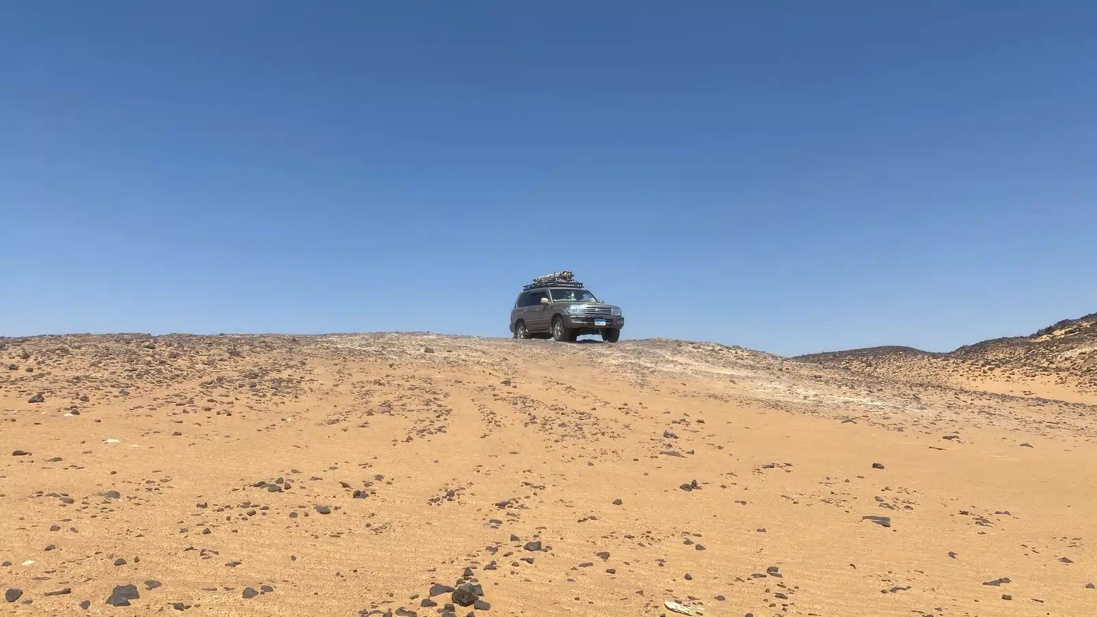
The Black Desert is a broad landscape near Bahariya Oasis in Egypt’s Western Desert. The English name describes appearance rather than a single formal landform. Dark stones and caps cover hills and ridges, creating strong contrast with pale brown or ochre ground. From a distance, some hills resemble dark cones; from the surface, visitors see loose fragments, bands and weathered material.
Tour routes use the name for a region rather than one fenced attraction. A local driver may choose a roadside panorama, a low walking stop or a named hill according to access, group ability and time. The exact route can change. This is why a responsible guide explains what is planned without giving a public turn-by-turn GPS track.
The Black Desert is distinct from the White Desert protected landscape, although both can appear in the same safari. The transition is part of the experience: agricultural palms and oasis settlements give way to dark ridges, then open corridors, mineral-rich stops and pale chalk forms. The broader Bahariya Oasis guide explains the starting region.
Do not confuse the Black Desert with black-sand beaches or another country’s volcanic field. Search descriptions should keep “Egypt,” “Bahariya” and “Western Desert” visible so the entity is unambiguous.
Why the Landscape Looks Black
The short tourism answer, “it is volcanic”, is too broad. Geological research describes Bahariya as a complex depression with sedimentary units, tectonic history, iron-rich materials and episodes of igneous activity. Some dark caps and stones are associated with basaltic or iron-rich material, but individual ridges can differ. Without a site-specific geological map and field analysis, a caption should not label every black fragment as basalt or every hill as a volcano.
Weathering helps create the visual effect. Dark material left across a lighter slope becomes concentrated and highly visible, especially when late light separates texture. Loose stones can move downslope and form a dark cover even when the entire hill is not made of the same rock. Iron oxides can also produce dark brown, red and black tones. The most accurate visitor description is often observational: dark-capped hills and black stone scattered over paler desert ground.
Academic work on the geological heritage of Bahariya and Farafra identifies the Black and White Deserts as important geomorphological features within a much more diverse regional history. That supports a careful story: the landscape is geologically valuable precisely because it cannot be reduced to one dramatic label.
How to read the landscape without overclaiming
Begin with relationships you can see. A dark cap may protect a softer slope beneath it, producing a table-like or conical profile as surrounding material erodes. Loose black fragments may spread outward from the upper ridge, while wind and gravity expose paler ground between them. One hill may show bands; another may look uniformly dark from a distance but reveal several colors close up. These observations are useful even when the exact mineral name is unknown.
Color also changes with conditions. Dampness, dust, haze and the angle of light can make the same stone appear brown, purple or nearly black. Camera processing can intensify that impression. A responsible caption should say when a description is visual and cite a geological source for composition. If the local team cannot confirm a named formation, leave the name out rather than turning a guess into a permanent web claim.
Where It Is and How It Fits the Bahariya to White Desert Route
Bahariya Oasis lies southwest of Cairo in the Western Desert. Black Desert stops are generally reached after the road journey to the oasis and before the route continues farther south toward other safari landscapes. The exact order depends on the start point, local roads, protected-area access, light and the operator’s plan.
| Route stage | Typical experience | Planning note |
|---|---|---|
| Cairo to Bahariya | Paved intercity transfer | Confirm pickup district and rest breaks |
| Bahariya base | Hotel, briefing, change to local 4×4 | Confirm luggage and meal timing |
| Black Desert region | Dark hills, panorama and short walk | Stop selected for current route |
| Southern route stops | Spring, Crystal Mountain, Agabat when suitable | Names and order are adaptable |
| White Desert | Chalk formations, sunset, camp | Camp follows conditions and current rules |
The table is a planning diagram, not navigation. Independent off-road driving creates safety and conservation risks. A local 4×4 team carries route knowledge, communications and recovery experience. Review White Desert tours from Cairo and Bahariya to see how the Black Desert fits different lengths.
The Best Viewpoints and Stops
There is no single official viewing platform that every itinerary must use. A common stop is a broad panorama where low dark hills repeat across the horizon. Another may place the 4×4 below a ridge so visitors understand scale. The best stop is one that is currently accessible, safe for the group and consistent with the route, not necessarily the one with the most dramatic social-media name.
Ask before walking uphill. Some surfaces are loose and eroded, and repeated climbing can create tracks. A short guided ascent may be possible at a locally selected hill, but the guide’s instruction applies. Avoid the skyline edge, maintain space from other guests, and return by the same durable path when asked.
For people with limited mobility, a vehicle-side panorama can still provide the essential view. Tell the team before departure so it can choose a stable stopping surface. Do not pressure a driver to park on a fragile slope for a photograph.
Named viewpoints sometimes change spelling or are used inconsistently online. The safest draft language is “a panoramic Black Desert viewpoint selected by the local team.” A precise name can be added only after local verification.
Choosing a stop for different travelers
Photographers benefit from an open view with foreground stones and room to change focal length. Families need a stable area where children can leave the vehicle without immediately meeting a steep slope. Older travelers may prefer a vehicle-side panorama with a shaded pause. A geology-focused guest may value a slower explanation at a modest outcrop more than the highest view. Send these priorities before departure so the driver can make a realistic choice within current access.
Keep the vehicle’s recovery path clear. Do not spread bags across the track or stand behind a reversing 4×4. When another group arrives, share the viewpoint rather than directing strangers out of the frame. A few minutes of patience generally produces an empty landscape without conflict.

How Long Do You Need?
A quick photo stop may take only enough time to step out safely, understand the landscape and make a few wide frames. A longer stop allows a short guided walk and time for layers, textures and vehicle-scale images. Sunset requires more schedule flexibility and may compete with reaching an approved camp location before dark.
On a day trip, the Black Desert is one element among several and should not consume the whole route. On a 2-day itinerary, it can be given a meaningful stop while preserving late light for the White Desert. A three-day trip creates more choice: the team may use one Black Desert stop in directional light and still slow down elsewhere.
The right duration depends on the traveler. A geology enthusiast may want explanation and close observation; a family may prefer a stable viewpoint; a photographer may need 45 minutes around changing light. State the priority before departure. The day trip versus overnight comparison helps match route time to the experience.
Never schedule a tight Cairo appointment based on a promised minute-by-minute return. Road traffic, access and group pace create variation.
Quick stop, one-hour stop or sunset?
A quick stop is suitable when the Black Desert is context within a larger one-day route. It should still include a safe exit, short explanation and time for a wide view. Around an hour makes sense for a short guided walk, several compositions and questions about the region. A sunset plan changes the whole day: the team must consider darkness, onward terrain and camp preparation. Ask what would be shortened elsewhere. “More time at sunset” is not free if it forces rushed driving or removes the best light from the White Desert.
Best Light for Photography
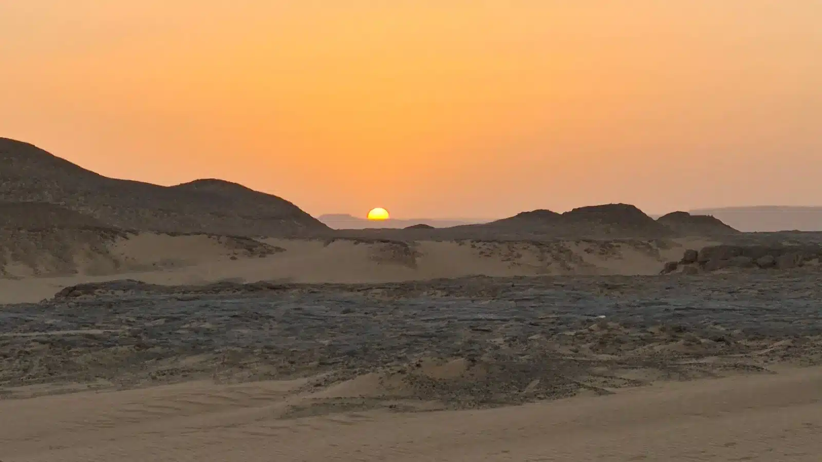
Side light reveals the dark stone against the lighter ground. Morning can be clear and graphic, while late afternoon can warm the ochre surface and turn ridges into silhouettes. Midday is not useless: high contrast can produce minimalist shapes, but cameras may lose detail in the darkest surfaces and brightest sky.
Expose for texture rather than automatically making every hill black. Check the histogram, protect highlights and lift shadows modestly in editing. Dust or haze can separate distant layers, but overprocessing removes the atmosphere that gives the view depth.
A medium focal length often works better than an ultra-wide lens because it stacks hills. Include the 4×4 only when safely parked and with the driver’s permission. For portraits, ask consent and avoid placing a person on a dangerous edge. A tripod is rarely necessary in full daylight but useful near sunset; keep its legs clear of paths.
Do not chase a sunset if the local team needs to continue to camp. The operational plan and safe driving take priority over one photograph.
Walking and Climbing: What Visitors Should Know
The Black Desert is not a network of standardized marked hiking trails. Most visitors take short guided walks from the 4×4. Loose stones can roll, dark surfaces can heat in sun, and slopes that look easy from below may be unstable. Wear closed shoes with grip and keep hands free.
Follow the guide’s limit. Do not separate from the vehicle, climb beyond sight or descend a different side. Carry water even for a short stop and use sun protection. Children stay with an adult. Travelers with balance, knee or heart concerns should choose the panorama from lower ground and seek personal medical advice if needed.
Walking sticks can be useful only when they do not scratch fragile surfaces or encourage a steeper climb. Avoid collecting stones as souvenirs. A loose-looking fragment is still part of the place and its cumulative removal changes the site.
Vehicle tracks are not automatically walking trails. Drivers choose surfaces according to sand, recovery options and current instructions. Do not post exact coordinates inviting unsupported travel.
Black Desert vs White Desert
| Feature | Black Desert | White Desert |
|---|---|---|
| Visual character | Dark-capped ridges, black stones, ochre ground | Pale chalk landforms and open white surfaces |
| Geology language | Complex; avoid calling every hill volcanic | Chalk/limestone erosional forms documented in protected-area sources |
| Typical experience | Panorama and short guided walk | Multiple formation stops, sunset and possible camp |
| Best light | Side light and silhouettes | Low-angle texture, blue hour and moonlight |
| Typical duration | One route segment | Often the central part of overnight routes |
| Camping | Not automatically at the viewpoint | Camp location selected according to current rules and conditions |
Neither is universally better. The Black Desert gives contrast and regional context; the White Desert supplies the concentrated chalk forms most visitors recognize. A balanced route does not turn either landscape into a rushed checkbox.
Travelers sometimes ask which should be removed when time is short. The answer depends on the trip’s purpose. A first-time visitor usually benefits from seeing both because the transition explains the Western Desert better than either landscape alone. A repeat photographer may choose longer time in one area. A family might use a brief Black Desert panorama and preserve energy for camp. Ask the operator to explain the driving consequence of every addition or deletion.
A Sample Black and White Desert Itinerary
Two days / one night
Begin from the confirmed Cairo or Bahariya start, meet the local team and change to the desert 4×4. Visit a current Black Desert panorama, then continue through suitable route stops such as a spring, Crystal Mountain and Agabat when accessible. Reach the White Desert for late light and camp. After sunrise and breakfast, visit additional chalk formations and return to Bahariya. The live 2 Days / 1 Night tour should be checked for current transfer wording and inclusions.
Three days / two nights
The extra night reduces pressure to fit every stop before sunset. A 3 Days / 2 Nights tour can leave more time for Agabat, photography, walking and a second camp opportunity. It does not guarantee a fixed camp or every named viewpoint; the route remains adaptable.
Travelers starting from Cairo should compare road time with experience time. An arrival hotel night may make the first day calmer. Ask where the quote begins and ends and how fees, meals, water, equipment and hotel use are listed.
Responsible Visiting
- Leave every stone and fragment where it is.
- Use the driver’s route; do not request off-track stunts.
- Walk only where the guide says the surface is suitable.
- Pack out bottles, tissues, food waste and cigarette ends.
- Do not carve, stack or rearrange stones for photographs.
- Observe wildlife quietly and never feed it.
- Ask permission before photographing guides or residents.
- Do not publish sensitive camp or wildlife coordinates.
Egypt officially declared the Black Desert/Bahariya area as a protected landscape in 2010 according to the Egyptian Environmental Affairs Agency. Current boundaries, access and operator arrangements should still be confirmed. Responsible behavior applies even where a visitor does not see a gate or sign.
The strongest proof of a good visit is not a stone in a suitcase; it is an image and an undisturbed landscape left for the next group.
Why “leave no trace” includes vehicle behavior
Litter is visible, but unnecessary tracks also accumulate. Drivers need flexibility for safe travel and recovery; visitors should not request circles, hill climbs or high-speed passes for video. Stay inside the vehicle when the team assesses soft ground. If another vehicle needs help, follow crew instructions and keep children away from ropes or recovery equipment. Responsible travel is quiet competence, not a staged adventure scene.
Camp waste should return with the group, including food scraps that can alter wildlife behavior. Cigarette ends, tissues and small plastic seals are easily lost in wind, so place them immediately in a closed bag. Never burn mixed waste. The operator decides any permitted cooking or fire arrangement under current rules.
What to Bring for This Stop
- Closed shoes with a familiar sole.
- Hat, sunglasses and family-chosen sun protection.
- Accessible drinking water.
- Light wind layer for exposed viewpoints.
- Camera cloth and sealed bag for dust.
- Small day bag that leaves hands free.
- Personal prescribed medication.
- No hammer, mineral tools or collection bags.
Heavy hiking equipment is unnecessary for a normal vehicle-based stop unless the operator confirms a longer walk. Keep luggage in the vehicle as instructed. In cooler conditions, have a warm layer ready instead of buried under camp equipment.
Frequently Asked Questions
Why is Egypt’s Black Desert black?
Dark stones and caps cover lighter desert ground, creating the name and strong contrast. The geology is complex and can include basaltic or iron-rich material, weathering and varied ridges. Not every hill should be assigned the same composition without site-specific evidence.
Is the Black Desert volcanic?
Bahariya has evidence of igneous activity and some dark materials are described as basaltic, but “the entire Black Desert is volcanic” is an oversimplification. Different landforms may have different histories. Use a credible geology source and a local guide’s site-specific explanation.
Can I visit the Black Desert from Cairo in one day?
Some day tours combine the long paved transfer with a limited desert route, but the schedule can feel rushed. Compare the time spent driving with the time at stops. An arrival night or overnight safari usually creates a calmer route. Confirm the exact Cairo pickup and return.
How far is it from Bahariya Oasis?
The Black Desert is near the wider Bahariya route, but distance depends on the selected stop and starting property. Avoid relying on a single map pin. Ask the local team for the day’s driving plan rather than public off-road navigation instructions.
Can you camp in the Black Desert?
Camping is not automatically allowed at any viewpoint. Current protected-area arrangements, suitable ground, wind, route and operator plan determine the campsite. Most packages place camp according to the wider Black and White Desert itinerary. Confirm the planned area without demanding exact coordinates.
Is the Black Desert included in White Desert tours?
It is commonly included on Bahariya to White Desert routes, but inclusions vary. Check the written itinerary for your date and ask which Black Desert stop is expected. Access, weather and timing may change the sequence.
What shoes should I wear?
Closed shoes with grip are appropriate for loose stones and short guided walks. Avoid new shoes or open sandals on a slope. Travelers with mobility concerns can enjoy many views from stable lower ground after discussing needs with the team.
Which is better for sunset: Black Desert or White Desert?
Both can work. The Black Desert gives strong silhouettes and dark ridges; the White Desert gives glowing chalk and long shadows. The best choice depends on the route, camp location, season and current access. Safe arrival at camp takes priority over chasing a fixed sunset point.